Cutting-edge tools in severe convective weather monitoring
Source: China Meteorological News Press
Date: 2020/06/17
Monitoring, forecasting, early warning and services of severe convection, especially mesoscale and small scale severe weather system, hold the key to meteorological disaster preparedness work. And refined monitoring lays the groundwork for accurate prediction and elaborate services and constitutes a crucial strength in ground based remote sensing monitoring system in future automatic observation in China. There are several “cutting-edge tools” in severe convective weather monitoring. Let’s have a good look at them.
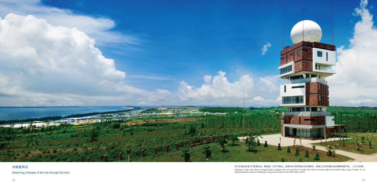
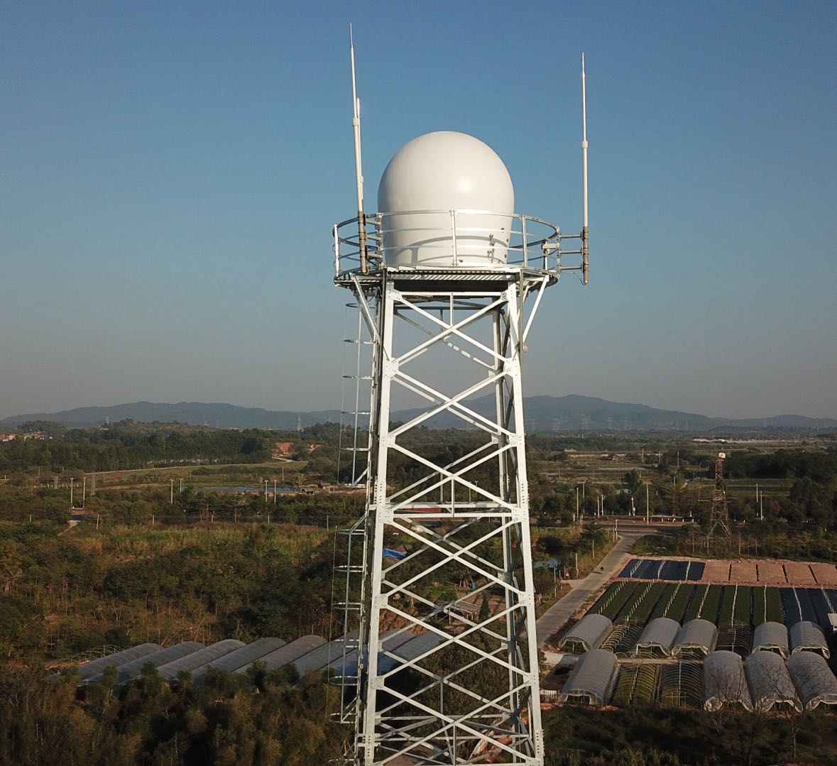
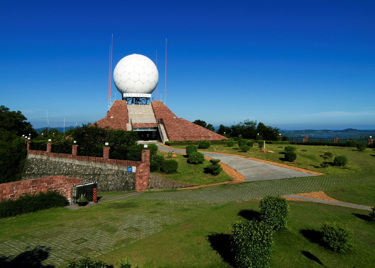
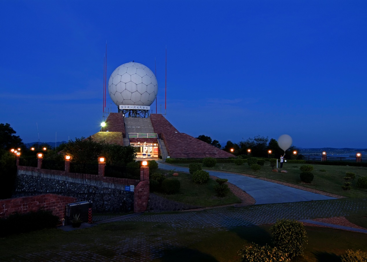
Dual polarization radar in Zhanjiang Provided by Wang Xiaopeng Phased array weather radar When to rain, how heavy is the rain and where will be the rain have always been the three major problems for forecasters in the world. Phased array weather radar has provided basis for solving these problems.
Phased array weather radar Provided by Tao Fa Phased array weather radar developed by China is a combination of multiple dissemination and reception units (each unit is tantamount to one miniature radar). It can carry out detection on its own or conduct coordinated operation. A multi-spectrum phased array weather radar is like many profiling antenna radar working together. This radar can detect one area with phased arrays distributed over different locations. When the potential heat is released which produces convection and affects the wind field, all data of the entire close-loop procedure from thermodynamics to dynamics, which has made the objectiveness of severe convective weather improve dramatically. From experiment to the application Currently, C spectrum and X spectrum phased array radars used in experiments in China are mainly laid out in Guangzhou, Gaoyou of Jiangsu, Daxing International Airport in Beijing, and Shanghai. In 2017, Guangzhou municipal meteorological department joined hands with relevant companies, carry out X spectrum dual-polarization phased array radar observation experiment, deployed 4 phased array radars, which nearly covered urban areas of Guangzhou. The experiment showcased that this radar has tremendous detection advantages in terms of monitoring rapidly developing and small scale weather system like local heavy rainfall, tornado, and hail.
Phased array weather radar Provided by Tao Fa In Gaoyou, Jiangxu where tornados are frequent, the first C spectrum phased array radar in China was being experimented here. In 2018, China Meteorological Administration (CMA) megacity integrated meteorological observation experiment project laid out X spectrum phased array radar in Shanghai. In August, 2019, typhoon Lekima affected Shanghai, the radar kept close tabs on the typhoon and obtained the complete wind field data, with the spatial resolution reaching 100 meters. In the future, this radar will become the next generation weather radar that can shoulder more daunting responsibilities. Dual polarization radar The horizontal and vertical channels of the radar can send out electromagnetic waves at the same time. The two channels can also receive echoes scattered by precipitation particles at the same time. This kind of radar is the updated version of sole polarization radar. The dual polarization camera has a high definition images with rich information, clear vision, and high identification.
Dual polarization radar Provided by Wang Cepeng The dual polarization radar can separate different forms of precipitation, better represent the size, form, precipitation type, and distribution of precipitation particles; has a strong capacity to resist against interruption and better identify meteorological echoes and non-meteorological echoes, and elevate the accuracy of precipitation and snow forecast. It is fair to say that the dual polarization radar can better monitor and warn against severe convective weather. Currently, dual polarization weather radar enters construction period in China. For instance, Guangdong took the lead in completing the upgrading of operational radar dual polarization in the whole province. In the next a few years, China will complete the transition from sole polarization radar to dual polarization radar. Meteorological departments are carrying out refined observation experiments from low spatial and temporal resolution to high spatial and temporal resolution. At that time, dual polarization radar will join forces with phased array radars, with quicker scanning and more refined data, which can completely monitor severe convective weather like rainstorm, hail and tornados.
Dual polarization radar Provided by Wang Cepeng Wind profile radar Wind profile radar harnesses the scattering of the atmosphere of electromagnetic waves to measure the wind field, which can provide three-dimensional wind field information on a real-time basis. Furthermore, it can coordinate with microwave radiometer or GNSS/MET water vapor monitoring system, which can realize the continuous remote sensing detection of factors like atmosphere, wind, temperature and humidity. This kind of radar is composed of L spectrum boundary layer radar, P spectrum troposphere radar, and VHF radar ranging from 40MHz to 68MHz. MST radar, a typical one in VHF radar, can detect the wind field information above 100 km at the maximum. L spectrum enhanced type wind profile radar is independently developed by China, with a detection height of 6 km, which can capture low atmosphere jet stream, upper trough
Wind profile radar Provided by Tao Fa They are distributed in Beijing-Tianjin-Hebei Region, Yangtze River Delta, Pearl River Delta, and other coastal regions. Wind profile radar operational experiment has formulated application approach and procedures. Data model assimilation pre-processing and assimilation approach R&D have been completed. It is predicted that in 2020, the wind profile radar data can be applied in regional 3-kilometer refined operational numerical weather model in GRAPES. In the future, wind profile radar, together with other atmospheric vertical profile three-dimensional observation network composed by vertical observation, will become key tools for gaining insight into atmospheric structure features and evolution. With the rapid assimilation of numerical model and the development of integrated technology, high temporal and spatial resolution atmospheric vertical profile observation will dramatically improve the accuracy of model prediction.
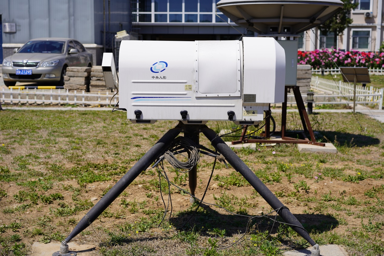
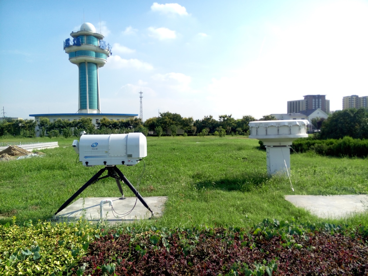
Wind profile radar Provided by Tao Fa Microwave radiometer It can detect small scale and mesoscale severe weather. It can calculate unstable energy and stratification height of the atmosphere by detecting temperature and humidity in the atmosphere, which provides environmental field monitoring for the emergence and development process of severe convection. The instrument mainly receives brightness temperature radiated by atmospheric molecules, receives brightness information from oxygen channel and water vapor channel, and detects temperature and humidity profile in the temperature based on diverse frequencies.
Microwave radiometer Provided by Mao Jiajia It is apt to detect severe convective weather, as well as monitoring daily weather processes, and realizing continuous profile monitoring of temperature, humidity, and wind by working with wind profile radars. This instrument joins hands with millimeter wave cloud radar, wind profile radar and aerosol laser radar to realize the coordinated observation and they have played a good role in monitoring severe convective weather, fog and haze, and daily weather processes.
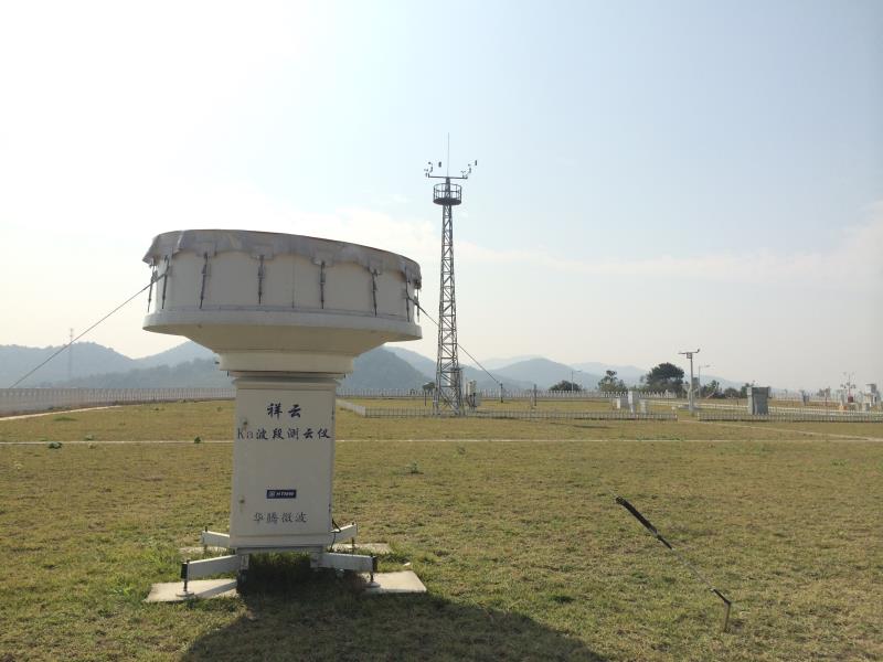
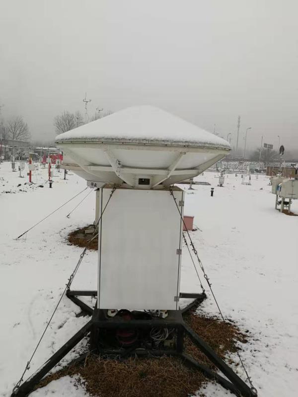
Microwave radiometer Provided by Mao Jiajia Cloud radar The cloud radar is designed to detect cloud particles. It is composed of Ka spectrum and W spectrum cloud radar. Ka spectrum cloud radar is independently developed and reached global advanced level. The W spectrum cloud radar is still in the pipeline. It can detect cloud height, cloud density, cloud microphysics parameter, as well as fog, cloud and weak precipitation. It is one of the best instruments in automatic cloud observation. Megacity experiment results show that cloud radar can observe formation and development of cloud hail, and realize early warning 20 to 30 minutes in advance.
Cloud radar Provided by Tao Fa In May, 17, 2019, hail emerged in many locations of Beijing. At that time, cloud radar echo could carry out refined observation of severe vertical movement happening at the altitude of 7 km to 10 km with the movement velocity of 10m/s. Currently, 15 cloud radars were laid out via the megacity experiment. In the future, cloud radar will play an instrumental role in severe convective weather observation, especially mesoscale and small scale severe weather prediction.(Jun.15)
Cloud radar Provided by Tao Fa Editor: Liu Shuqiao Previous issues
|